| West Roxbury was originally part of the town of Roxbury. It seceded from Roxbury in 1851 and was annexed by Boston in 1874. The town had included the neighborhoods of Jamaica Plain and Roslindale. |
|
| Hills of West Roxbury - Boston, Mass. |
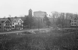
| Bellevue Hill |
| • |
USGS identified - MassMapper MassGIS |
| • |
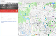
Google Maps | Google Earth - Google |
| • |
"...Muddy Pond Hill, the highest elevation in Roxbury, has lately been rechristened 'Mount Bellevue'...", Drake, pg 437, 1908 - Internet Archive |
| • |
"...The ice-sheet also molded some of the drift of this area into drumlins. Bellevue Hill is the most important of these, and the only well-developed drumlin actually within the limits of the reservation...", Report of the Board of Metropolitan Park Commissioners, pg. 63, 1895 - HathiTrust |
| • |
Bellevue Standpipe, "...Bellevue Hill (elevation 370 ft.), the highest point in the city of Boston, was reportedly given to the city by William Blakemore, a real estate developer and land owner..." - Massachusetts Cultural Resource Information System (MACRIS) |
| • |
Bellevue Hill - USGS Geographic Names Information System |
|
| Candle Hill |
| • |
"...Candle Hill, on the narrow section of Charles River at West Roxbury, divides first and second ponds travelling towards Newton. This was used by the boys for swimming purposes in the old days and derived its name from stories told by the early settlers of seeing lighted candles at night on the hill...", West Roxbury, Boston 200 Neighborhood Histories Project, pg. 10, 1976 - Internet Archive |
|
| Chapel Hill |
|
| Milkwood Hill |
|
| Millennium Park |
|
| Over Brook Ledge |
|
| Peaked Hill |
|
|
|
 |
|
 |
|
 |
|
 |
|
| Bellevue Hill |
 |
|
| Millennium Park |
 |
|
|
| West Roxbury Maps |
| • |
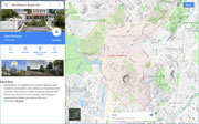
West Roxbury - Google Maps, Terrain |
| • |
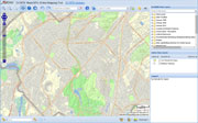
West Roxbury - MassMapper MassGIS |
| • |
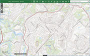
West Roxbury - USGS - The National Map |
| • |
Newton Quadrangle - 2018 (60 MB PDF) - USGS Topo Download |
| • |
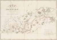
Map of the Town of Roxbury, Massachusetts, John G. Hales, 1832 - Norman B. Leventhal Map Center, Boston Public Library |
| • |
City of Roxbury, Massachusetts, Charles Whitney, 1849 - Norman B. Leventhal Map Center, Boston Public Library |
| • |
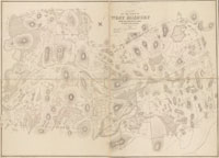
Plan of Town of West Roxbury, Mass., Theodore B. Moses, 1873 - Norman B. Leventhal Map Center, Boston Public Library |
| • |
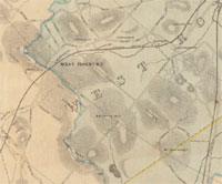
Atlas of West Roxbury, City of Boston, G.W. Bromley, 1924 - State Library of Massachusetts |
| • |
Atlas of Dorchester, West Roxbury, and Brighton, West Roxbury, Plate 17, L.J. Richards, 1899 - State Library of Massachusetts |
| • |
Map of Dorchester, Roxbury, and West Roxbury, Geo. H. Walker & Co, 1907 - Norman B. Leventhal Map Center, Boston Public Library |
| • |
Map of Norfolk County, Massachusetts, Henry F. Walling, 1853 - Library of Congress |
| • |
Plan of Boston and its Vicinity, Showing the Drainage Area of Stony Brook, H.M. Wightman, 1863 - Norman B. Leventhal Map Center, Boston Public Library |
| • |
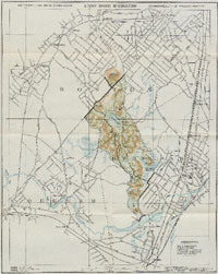
Flora of the Stony Brook Reservation, Metropolitan Park Commission, 1896 - WikiMedia Commons |
| • |
Stony Brook Reservation Trail Map (PDF), Stony Brook Reservation - DCR, Commonwealth of Massachusetts |
|
|
| West Roxbury Sources |
| • |
The Town of Roxbury its Memorable Persons and Places, A Volume of Records Relating to the Early History of Boston, Francis S. Drake, Vol. 34, 1908 - HathiTrust |
| • |
West Roxbury, Boston 200 Neighborhood History Series, 1976 - Internet Archive |
| • |
The Memorial History of Boston including Suffolk County, Massachusetts, 1630-1880, Vol. 3, Justin Winsor, 1881 - Internet Archive |
|
|
|